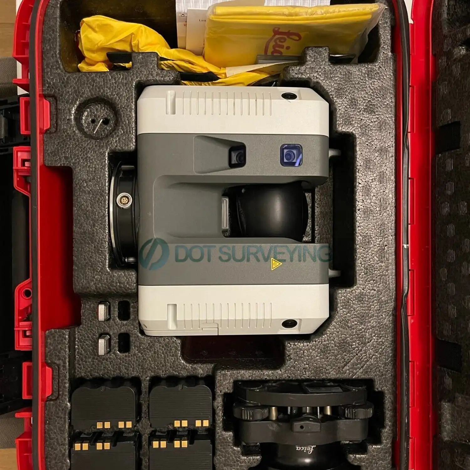
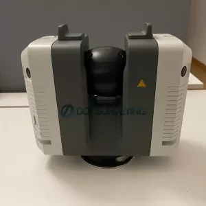
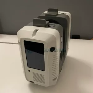
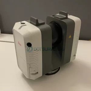
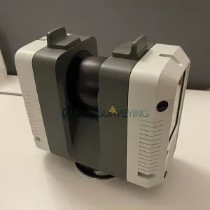
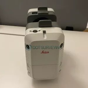
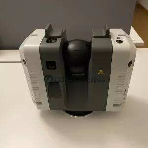
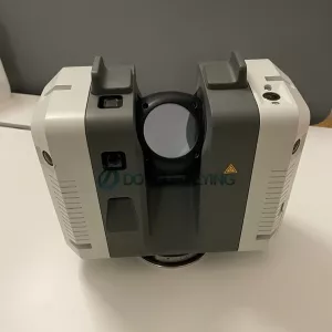
Leica RTC360 Laser Scanner
Used Leica RTC360 for sale, everything is great and fully operational, been tested, serviced and calibrated by Leica to be ready to work on capturing and capitalizing on the Scan-to-BIM and reality capture markets.
Low hour scan used, has Leica RTC360 Laser Scanner CCP Silver includes 1 year warranty, yearly calibration and cleaning, service, firmware updates, individual instrument error report.
Includes;
- Leica RTC360 Laser Scanner with Leica CCP Silver 1 Year
- Cyclone REGISTER Subscription
- 1X Cyclone PUBLISHER Subscription
- Field 360 Cyclone FIELD 360 - On-Site Registration App - Up to five (5) simultaneous deployments on any mobile device
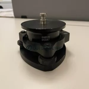
- GDF323 Tribrach
- GAD120 Adapter to tribrach
- Transport Container
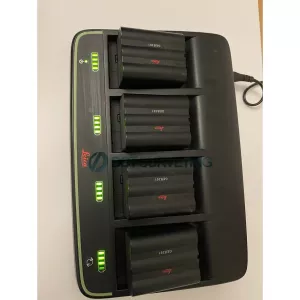
- 4X Lithium-Ion Battery
- Multi changer Prof 5000 including power cable
- 2X USB 3.0 flash drive - USB 256GB
- RTC Rain Cover
- System USB Card
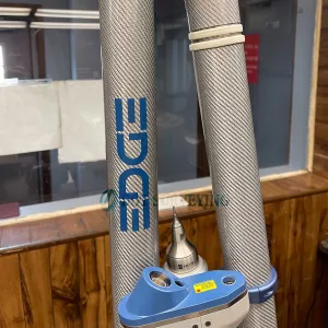
- Carbon fiber tripod
- GVP736 Backpack
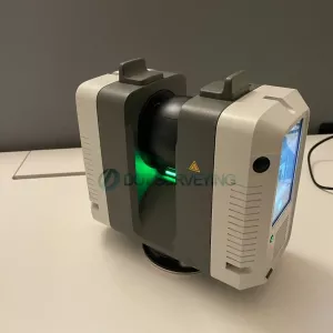
Leica RTC360 3D Laser Scanner
Automatically pre-register point cloud data in the field to quickly conduct quality control checks, improve productivity and make better-informed decisions on site. The Leica RTC360 3D reality capture solution empowers users to document and capture their environments in 3D, improving efficiency and productivity in the field and in the office through fast, simple-to-use, accurate, and portable hardware and software. The RTC360 3D laser scanner is the solution for professionals to manage project complexities with accurate and reliable 3D representations and discover the possibilities of any site.
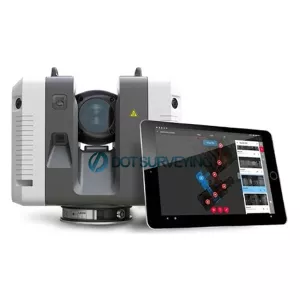
Highly portable, highly automated, intuitive and designed for maximum productivity, the RTC360 solution efficiently combines the RTC360 a high-performance 3D laser scanner, Leica Cyclone FIELD 360 mobile-device app for edge computing for automatically registering scans in real time, and Leica Cyclone REGISTER 360 office software to integrate your 3D model seamlessly into your workflow.
- Capture scans, including enriching High-Dynamic Range (HDR) imagery, in less than two minutes.
- Automatically record your moves from station to station to pre-register your scans in the field without manual intervention.
- Augment your data capture with information tags illustrating the opportunities for better planning, reflect site reality, and boost your teams’ situational awareness
- Directly publish your captured data from Cyclone FIELD 360 to Leica TruView Cloud to quickly exchange project information prior to import and registration
Fast: The new Leica RTC360 laser scanner makes 3D reality capture faster than ever before. With a measuring rate of up to 2 million points per second and advanced HDR imaging system, the creation of coloured 3D point clouds can be completed in under two minutes. Plus, automated targetless field registration (based on VIS technology) and the seamless, automated transfer of data from site to office reduce time spent in the field and further maximise productivity.
Agile: Small and lightweight, the Leica RTC360 scanner’s portable design and collapsible tripod mean it’s compact enough to fit into most backpacks, ready to be taken anywhere. Once on-site, easy-to-use, one-button operation makes for fast, hassle-free scanning.
Precise: Low noise data allows for better images, resulting in crisp, high-quality scans that are rich in detail and ready for use in a range of applications. Combined with Cyclone FIELD 360 software for automated registration in the field, the Leica RTC360 scanner offers outstanding precision that can be checked on-site.
Pre-registraton in the field: As part of the RTC360 solution, the Cyclone FIELD 360 app links the 3D data acquisition in the field with the laser scanner and data registration in the office with Cyclone REGISTER 360. On-site the user can automatically capture, register and examine scan and image data. The user interface combines easy handling of complex calculations with a graphical user guidance that offers a remarkable user experience, also for novice users.
What is 3D Reality Capture
3D reality capture is a process of scanning and capturing any site, for example plants, buildings or crime scenes, in a 3D digital model, combining measurements and imagery. The resulting model can be used for design and comparison purposes, to ensure site safety in inhospitable environments or as evidence in a criminal case, capturing every detail with to-the-millimetre accuracy.
3D Reality Capture enhances the understanding of our environment
As technology has become smaller, more affordable and more automated, 3D reality capture has become increasingly accessible to a wider range of applications, putting control in the hands of those that may have required specialists in the past. The latest solutions combine one-touch operation with portability and speed to deliver high levels of accuracy, automation and the ability to create 3D environments in a matter of minutes.
Opportunities
- Automated comparison of as-built to design-intent (BIM)
- Enhanced safety in inhospitable environments through 3D modeling
- Accurate as-built detail for maintenance or extension design of complex plant
- Court-ready evidence documentation with accurate and visual detail jurors can understand
- Detailed as-built documentation for future reference
- Quality assurance of projects, reducing additional expenditures
- Quickly capturing every detail of crime scenes or accidents, reducing disruption
Cyclone FIELD 360
The high-performance Leica Cyclone FIELD 360 mobile-device app is the perfect field companion for the Leica RTC360 3D laser scanner. With its intuitive user interface, remote scanner control and on-site point cloud display, navigation is a breeze - even for novice users – with full imagery and point cloud data delivered directly to the tablet using edge computing technology.
RTC360 data captured in the field is also immediately available in multiple software applications, serving field tags, assets, HDR imagery and 3D point cloud in JetStream powered solutions. In conjunction with the release of the RTC360 solution, a full release of the Cyclone product family is scheduled together with hardware shipments.
|
|
|
| GENERAL | |
| 3D Laser Scanner | High-speed 3D laser scanner with integrated HDR spherical imaging system and Visual Inertial System (VIS) for real time registration |
| PERFORMANCE | |
| Data acquisition | <2 mins for complete full dome scan and spherical HDR image at 6mm @ 10 m resolution |
| Real time registration | Automatic point cloud alignment based on real time tracking of scanner movement between setups based on Visual Inertial System (VIS) by video- enhanced inertial measurement unit |
| Double scan | Automatic removal of moving objects |
| SCANNING | |
| Distance measurement | High-speed, high dynamic time of flight enhanced by Waveform Digitising (WFD) technology |
| Laser class | 1 (in accordance with IEC 60825-1:2014), 1550 nm (invisible) |
| Field of view | 360° (horizontal) / 300° (vertical) |
| Range | Min. 0.5 - up to 130 m |
| Speed | Up to 2,000,000 pts / sec |
| Resolution | 3 user selectable settings (3/6/12 mm @ 10 m) |
| Accuracy | Angular accuracy 18” Range accuracy 1.0 mm + 10 ppm 3D point accuracy 1.9 mm @ 10 m 2.9 mm @ 20 m 5.3 mm @ 40 m |
| Range noise | 0.4 mm @ 10 m, 0.5 mm @ 20 m |
| IMAGING | |
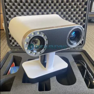
| Camera | 6 MP 3-camera system captures 432 MPx raw data for calibrated 360° x 300° spherical image |
| Speed | 1 minute for full spherical HDR image at any light condition |
| HDR | Automatic, 5 brackets |
| NAVIGATION SENSORS | |
| Visual Inertial System | Video enhanced inertial measuring system to track movement of the scanner position relative to the previous setup in real time |
| Tilt | IMU based, Accuracy: 3‘ for any tilt |
| dditional sensors | Altimeter, Compass, GNSS |
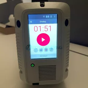
| OPERATION | |
| On scanner | Touch-screen control with finger touch, full colour WVGA graphic display 480 x 800 pixels |
| Mobile devices | Leica Cyclone FIELD 360 app for iPad or Android tablets including: - Remote control of scan functions - 2D & 3D data viewing - Tagging - Automatic alignment of scans |
| Wireless | Integrated wireless LAN (802.11 b/g/n) |
| Data storage | Leica MS256, 256 GB exchangeable USB 3.0 flash drive |
| DESIGN & PHYSICAL | |
| Housing | Aluminium frame and sidecovers |
| Dimensions | 120 mm x 240 mm x 230 mm / 4.7‘‘ x 9.4‘‘ x 9.1‘‘ |
| Weight | 5.35 kg / 11.7 lbs, nominal (without batteries) |
| Mounting mechanism | Quick mounting on 5/8“ stub on lightweight tripod / optional tribrach adapter / survey tribrach adapter available |
| POWER | |
| Internal battery | 2 x Leica GEB361 internal, rechargeable Li-Ion batteries. Duration: Typically up to 4 hours Weight: 340 g per battery |
| External | Leica GEV282 AC adapter |
| ENVIRONMENTAL | |
| Operating temperature | -5° to +40°C |
| Storage temperature | -40° to +70°C |
| Dust/Humidity | Solid particle/liquid ingress protection IP54 (IEC 60529) |