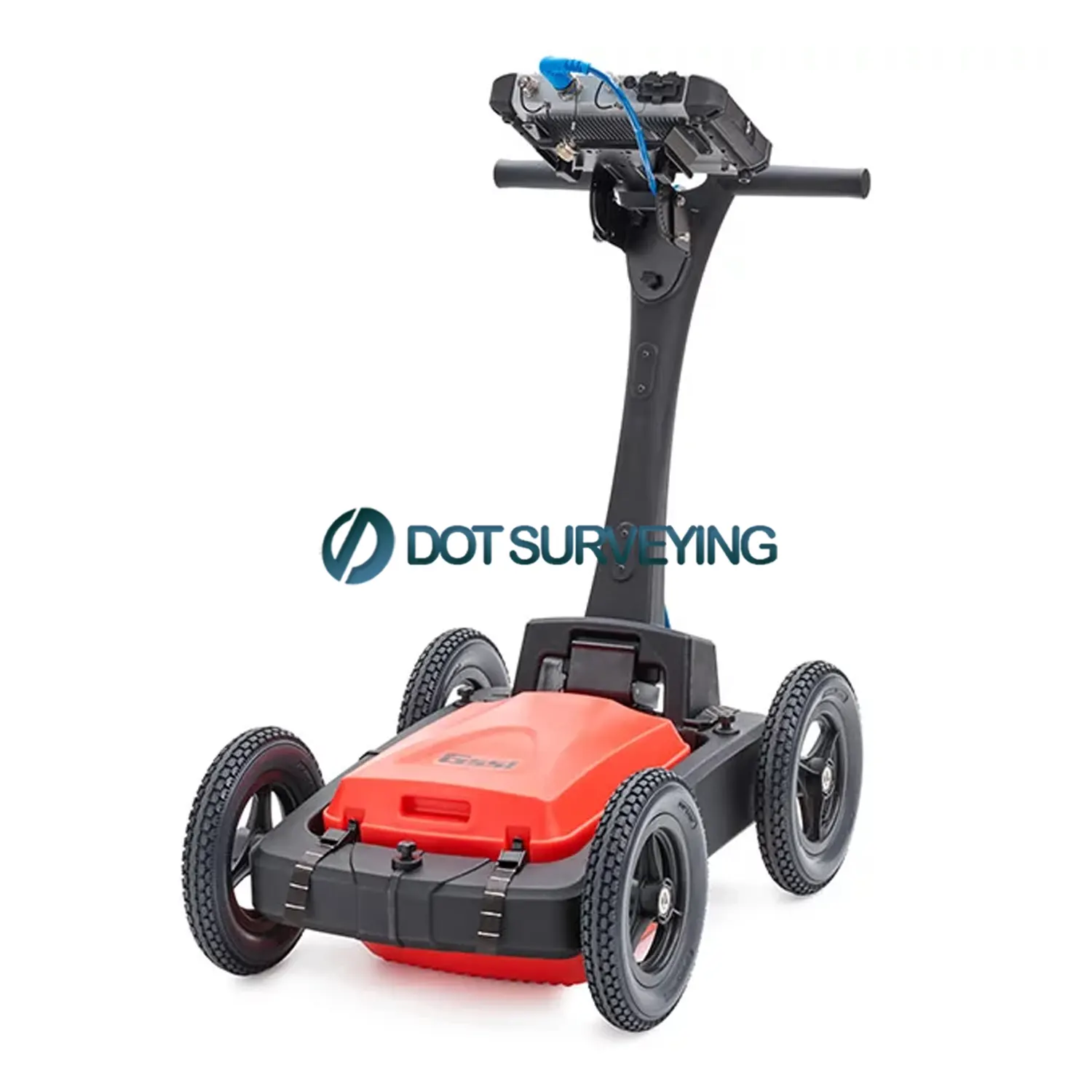


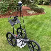
GSSI UtilityScan Pro GPR

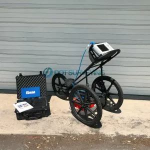
For sale GSSI UtilityScan Pro GPR for Utility Mapping and Locating, included GSSI SIR 4000 Control Unit, 400 MHz, 300/800 DF, or 350 HS Antenna, 3-wheel or 4-wheel cart and 2-year GSSI warranty
With GSSI UtilityScan Pro, users can quickly identify and mark the position and depth of metallic and non-metallic objects; including utilities such as gas, communications and sewer lines as well as underground storage tanks and PVC pipes. Based on the SIR 4000 controller, the UtilityScan Pro provides the GPR professional with solutions to any underground locating situation.
GSSI UtilityScan Pro GPR sale Includes
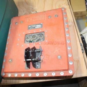
- GSSI SIR 4000 Control Unit
- 400 MHz, 300/800 DF, or 350 HS Antenna
- Choice of 3-wheel or 4-wheel cart
- 2 m control cable
- SIR 4000 sunshade
- SIR 4000 AC/DC power supply
- Lithium-ion battery (2)
- Dual-bay battery charger
- Transit case
- 2-year GSSI warranty
The UtilityScan Pro is typically used for:
- Underground utility detection
- Environmental remediation
- Damage prevention
- Geological investigation
- Archaeology
- Forensics
- Road inspection
Expect more from your GPR utility system, The UtilityScan Pro system provides a non-destructive means to accurately locate underground utilities and shallow geophysical characteristics.
Fully Customizable System: Users can customize the UtilityScan Pro with multiple antenna offerings and cart options. The tailored options provide survey flexibility, from smooth prepared surfaces to rugged terrain with our rugged four-wheel cart, and suit a number of utility locating applications.
Mark with Confidence: The UtilityScan Pro delivers exceptional data quality and is rugged enough to withstand the job site’s toughest conditions. Locate subsurface utilities with confidence.
Data Visualization: The UtilityScan Pro system features our state-of-the-art SIR 4000 controller and can incorporate an optional AC power accessory. The SIR 4000 controller incorporates advanced display modes and filtering capabilities for in-the-field processing and imaging. The LineTrac accessory for digital antennas adds the ability to detect AC power and induced RF energy present in buried utilities.
GSSI UtilityScan Pro GPR Scanning offers a variety of construction related services to aid site supervisors, project managers, property owners/managers, engineers, and architects in evaluating and locating structures and utilities. Experienced technicians coupled with cutting edge technology generate accurate, real-time results to keep your project on schedule and hassle free. Pro Scanning Services Include:
- Concrete GPR Scanning
- Utility GPR Scanning
- Utility Tracing
- Video Pipe Inspection/Tracing
GSSI Utility Scan Pro Specifications
| System | SIR 4000 |
| Antennas | Compatible with all GSSI antennas |
| Number of Channels | Records data from 1 single-frequency antenna or 1 dual-frequency antenna |
| Data Storage | 32 GB Flash, 1 GB RAM |
| Display | Enhanced 10.4” LED display with internal high brightness, Active matrix 1024 x 768 resolution and 32-bit color |
| GPS | Data logged internally |
| Display Modes | Linescan, Linescan plus O-scope, Wiggle trace Full 3D, 256 color bins are used to represent the amplitude and polarity of the signal |
| Environmental Rating | IP65 |
| Data Acquisition | |
| Data Format | RADAN® (dzt) |
| Output Data Format | 32-bit |
| Scan Interval | User-selectable, up to 4000 scans/sec |
| Number of Samples per Scan | 256, 512, 1024, 2048, 4096, 8192, 16384 |
| Operating Modes | Continuous (time) or survey wheel (distance triggered) or point mode |
| Time Range | 0-20,000 nanoseconds full scale, user-selectable Gain: manual adjustment from -42 to +126 dB Number of segments in gain curve is user-selectable from 1 to 8 |
| Standard Real-Time Filters | Infinite Impulse Response (IIR) - Low and High Pass, vertical and horizontal - Finite Impulse Response (FIR) - Low and High Pass, vertical and horizontal |
| Advanced Real-Time Filters | Migration, Surface Position Tracking, Signal Noise Floor Tracking, Adaptive Background Removal |
| Automatic System Setups | Storage of an unlimited number of system setup files for different survey conditions and/or antenna deployment configurations |
| Automatic Antenna Recognition | Automatic recognition of Smart Antennas to allow maximum compliant transmit rate |
| Languages | English, Chinese, Japanese, French |
| Operating | |
| Operating Temperature | -20°C to 40°C external (-4°F to 104°F) |
| Battery | Inspired Energy Ni2040ED, 3 hour runtime (battery life dependent on level of display brightness) |
| Transmit Rate | Up to 800 KHz (International) US/Canada and CE rates depend on antenna model |
| Input/Output | |
| Available Ports | Antenna inputs analog and digital (one at a time), DC power input, Serial RS232 (GPS port), Accessory connector, HDMI video output, Ethernet to PC, USB 2.0 port, mini USB |
| Ethernet | RJ45 100BT Ethernet |
| USB Host | USB host with external keyboard support, USB flash drive support and USB HUB support |
| Mechanical | |
| Dimensions | 14x10x2.75 in (36x25x7 cm) |
| Weight | 10 lbs (4.53 kg) including battery |
| Relative Humidity | <95% non-condensing |
| Storage Temperature | -40°C to 60°C (-40°F to 140°F) |
Accessories
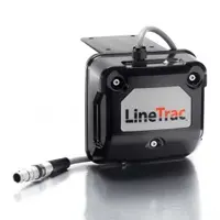 LineTrac
LineTrac adds the ability to detect AC power and induced RF energy present in buried utilities. This accessory is compatible with the 300/800 DF antenna and the 350 HS antenna.
 GPS Tripod
The GPS tripod is constructed with carbon fiber tubing and ram mount fixings. It is compatible with GSSI’s 3-wheel carts.
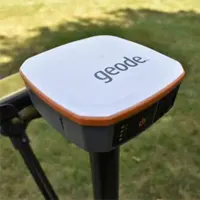 Geode GPS
The Geode GPS is a Multi-GNSS with 9-pin serial port, 1 Hz model. The Geode GPS is compatible with the UtilityScan, PaveScan RDM 2.0 and SIR 4000 based systems.
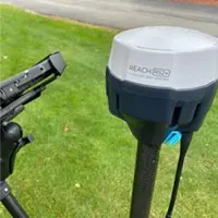 EMLID Reach RS2+
The Reach RS2+ is a survey-grade-capable GPS that operates as a single unit or in base/rover mode with two units. The RS2+ is compatible with UtilityScan, UtilityScan Pro, UtilityScan DF/HS, 200 HS antenna, RoadScan, and PaveScan 2.0
Resources