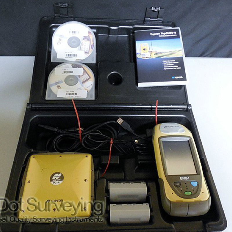
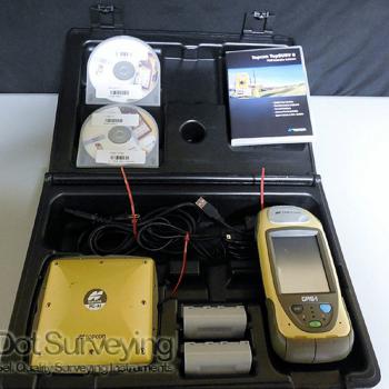
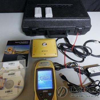
Topcon GRS-1 GNSS RTK PGA-1 Antenna

Topcon GRS-1 GNSS RTK PGA-1 Antenna for sale with TopSurv with optical, GPS, GIS, & roads unlocked
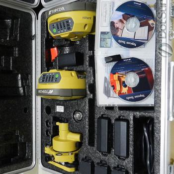
Very lightly used, excellent like new condition, everything is has been checked, tested ready to work, is in full working order plus includes the case & accessories.
Topcon GRS-1 RTK Kit comes with:
- Topcon GRS-1
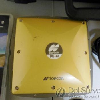
- Topcon PGA-1
- PGA-1 antenna cable
- 2x Antenna cable pole clips
- SI GRS-1 pole clamp assy
- Batteries
- USB cable
- Serial cable
- Charger
- Pack of screen protectors
- Stylus
- Carrying case
- Copy of GRS-1 parts breakdown and parts list also available if wanted
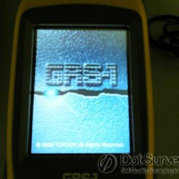
Topcon GRS-1 Receiver
Topcon continues to enhance GNSS receivers by adding Vanguard TechnologyTM to the already successfull GRS-1. The GRS-1 now featuring Vanguard TechnologyTM has 226 GNSS channels that use Universal Tracking Technology for unmatched GNSS signal flexibility and expandability. It is all-in-one handheld GNSS receiver and field controller with high speed processor, bright sunlight readable screen, and optional camera. It is packed with communications as well. Bluetooth®, Wifi, and optional internal CDMA or GSM modem.
Features & Benefits:
- 226-channel Vanguard Technology with Universal Tracking Channels
- Internal GNSS Antenna
- Internal GSM or CDMA Cellular Modem
- Windows Mobile Operating System
- 2.0 Megapixel Camra (optional)
- Built-in Bluetooth® and Wifi
Topcon’s new GRS-1 (Geodetic Rover System) is the world’s first fully integrated dual constellation network enabled RTK rover system. It is an all-in-one handheld GNSS receiver and field controller featuring high-speed processor, increased memory, built-in camera and digital compass. Also integrated are an SD memory card slot, optional internal GSM or CDMA modem, and wireless connectivity via Wireless LAN and Bluetooth® wireless technology.
The GRS-1 achieves three primary and evolutionary goals for a GNSS receiver: small size, minimal weight, and affordability. It provides DGPS capability via an internal L1 antenna, perfect for the GIS and navigation space. Instantly move to centimeter RTK accurate dual frequency / dual constellation GNSS by simply adding a carbon-fiber pole with Topcon’s PG-S1 external antenna then connect to your local GNSS network via the internal modem. As an added benefit, the GRS-1 can also be used as a static post processed receiver system.
Built-in 2.0 Megapixel Camera: that’s right, the GRS-1 comes with a 2.0 megapixel camera with autofocus for taking pictures. Store photos on-board with the 1GB of Flash memory or use the external SD card slot for additional memory.
Internal Magnetic Compass: Utilizing compass bearing with GNSS positioning, the magnetic compass allows for additional measurements to be taken from a single location.
Extra Memory: With 1GB Flash standard, the GRS-1 is loaded with memory. But if you need more, the SD card slot and the mini USB Host functionality can provide additional memory. Use the USB mini port as both a Host and Client. This functionality allows for expanded memory and easy file transfer through USB flash drives or SD memory cards.
Bluetooth and Wireless LAN: Built-in Bluetooth wireless technology and Wireless LAN connectivity come standard. No need for expensive upgrades or CF cards. Use your device in a typical Hotspot to surf the web, check weather or e-mail files back to the office. When not in use, Topcon also provides a way to turn Bluetooth and Wireless LAN off to conserve battery power.
Available Application Software: Topcon’s MAGNETTM Software : A family of software solutions that streamlines the worklow for surveyors, contractors, engineers, and mapping professionals. MAGNET is a suite of productivity software products that increase productivity through collaboration of office and field data. From the intuitive user interface running on a field controller, to the cloud-linked office CAD software, and web-browser Enterprise interface, MAGNET Solutions provides a new increased level of productivity.
Pocket-3D: Puts the power of GNSS based site managment in the hands of site foremen and grade checkers, making it easy to verify machine control activities.
eGIS: Designed to be easy and intuitive, eGIS is the best software solution for location based information recording for mobile GIS solutions. Configurable to user needs, and compatible with arcPad and PDF maps.