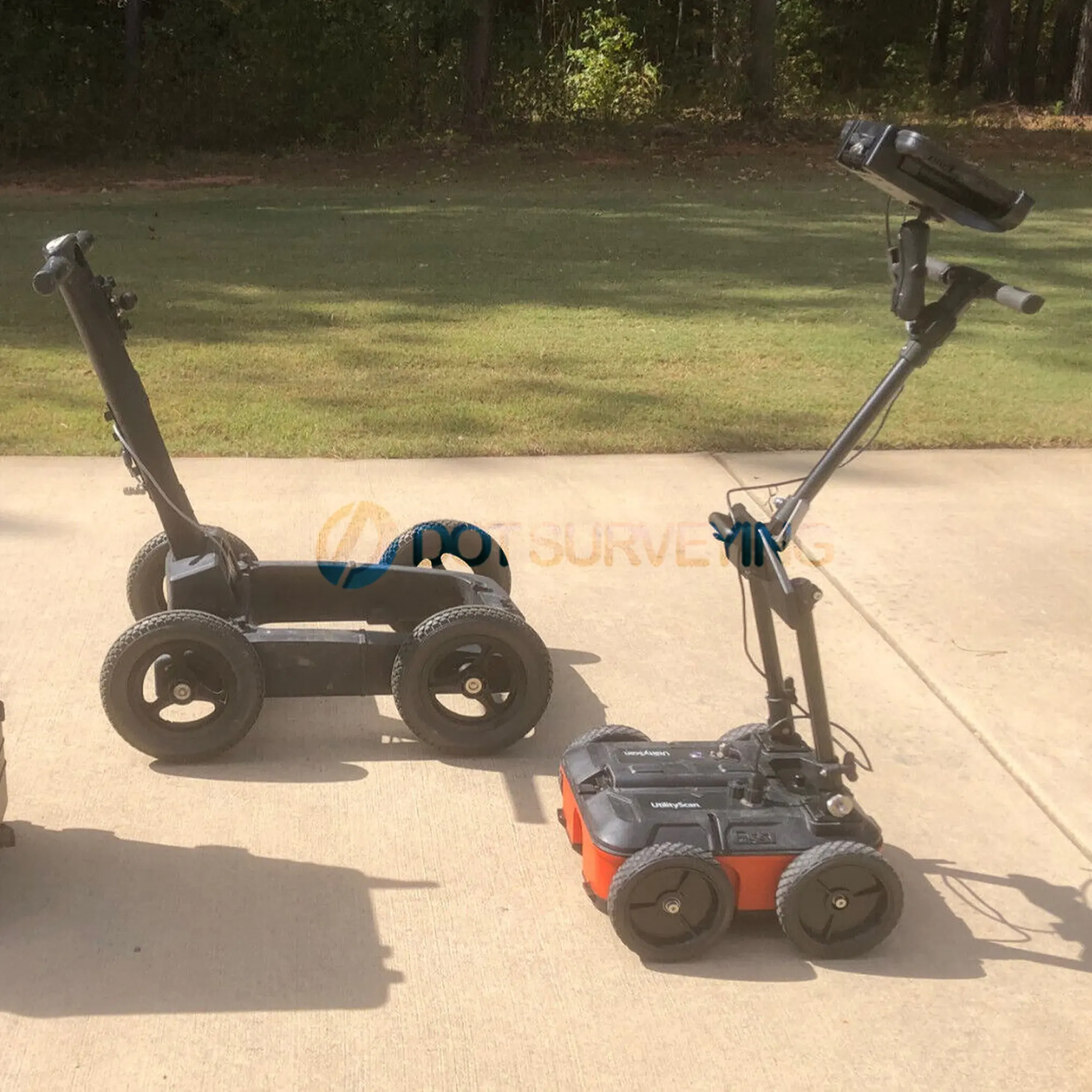
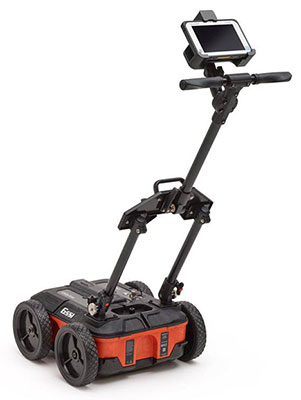
GSSI Utility Scan GPR 350 MHz Antenna


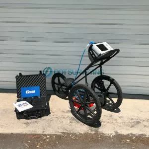
Sale GSSI Utility Scan GPR 350 MHz Antenna, clean unit, everything is in excellent working and works flawlessly condition. Fully inspected and serviced by GSSI authorized to meets GSSI high standards for performance and reliability.
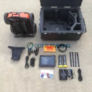
Package includes;
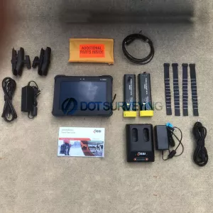
- GSSI UtilityScan unit
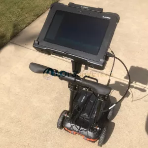
- Rugged Zebra Tablet
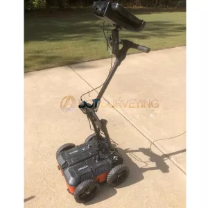
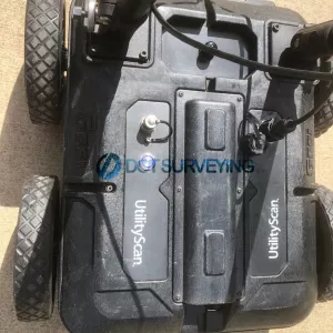
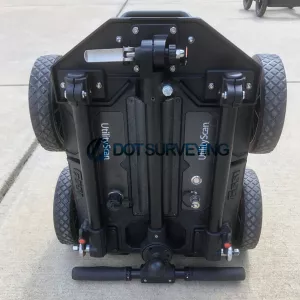
- GSSI 350 MHz Hyper Stacking antenna
- Integrated LineTrac accessory
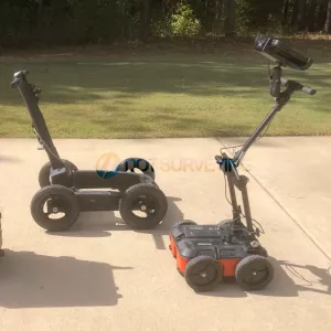
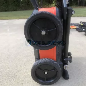
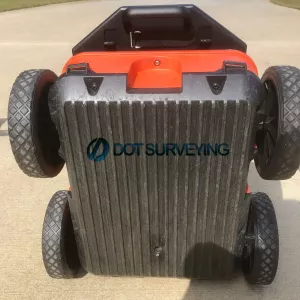
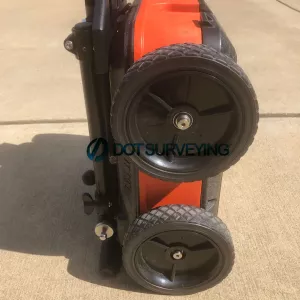
- Integrated cart
- Additional Rugged Four-Wheel Cart
- (2X) Lithium-ion batteries
- Dual-bay battery charger
- Quick Start Guide
- Transit Case
- Additional cables and mounting hardware
GSSI UtilityScan GPR 350 MHz antenna designed for high-performance ground penetrating radar applications. This premium gpr equipment is perfect for utility mapping and locating, offering accurate and reliable results.
Key Features:
- 350 MHz frequency range for optimal performance
- High-resolution data for precise results
- Patented HyperStacking technology for improved depth penetration
- Compatible with GSSI's SIR 4000 control unit and other GPR systems
GSSI UtilityScan GPR System Optimized for Utility Locating
 Locating and marking underground utilities in real-time in the field has been a powerful application of ground penetrating radar (GPR) for many years. A knowledgeable utility locator with a GPR system as part of their toolbox is able to accurately identify buried utilities. UtilityScan is built for the utility locating professional to accelerate workflow from target detection to reporting.
The UtilityScan is typically used to:
- Scan utilities – metallic and non-metallic
- Locate water lines
- Detect voids and underground storage tanks (USTs)
- Identify soil and foundation characteristics
- Locate shallow objects for archaeology
UtilityScan GPR system, with a new user interface (UI) that makes it easier than ever to locate and mark the depth of underground utilities in real-time in the field.
With real-time target mapping, advanced scanning and identification capabilities, the rugged and flexible UtilityScan helps utility locating professionals accelerate workflow from target detection to reporting.
UtilityScan is ideal for marking the location and depth of subsurface utilities, including gas, sewer, and communication lines. Real-time target mapping features include a new Map Mode that allows users to trace their steps and gain a bird’s-eye view of their survey. Users can also simultaneously place APWA color-coded marks on 2D data and a geo-referenced map.
With the updated UI, users can collect and create 3D scans. The on-screen 3D data collection mode allows users to easily define the time slice depth and thickness in the field with the 3D data on the screen. The map window can be minimized to view the 3D display full screen.
The rugged, flexible system is rated IP65, with durable components tested to withstand the most challenging survey environments, including rain, dust, and extreme cold down to 4°F. The integrated Panasonic G2 tablet screen is designed for rain and glove use. For areas where Wi-Fi is prohibited, the system includes a rugged Ethernet cable that can be used for communication between the tablet and antenna.
UtilityScan is available with the optional LineTrac® power detection module, which enables identification and tracing of the precise location of underground electric and RF-induced utilities. This allows the detected power or induced frequencies data to be overlaid on the radar data, providing reliable positioning and target information. This system is compact and portable, only weighing 34 pounds.
Download